


Rigobert Bonne
French
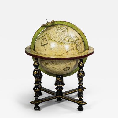
Rigobert Bonne (1727–1794) was a French cartographer and hydrographer who made significant contributions to the field of geography during the 18th century. He was born in Ardennes, France, and worked as an engineer and draftsman for the French Navy.
Bonne is known for his work as a mapmaker and geographer. He produced numerous maps and atlases that were highly regarded for their accuracy and attention to detail. His maps covered various regions, including Europe, Africa, Asia, and the Americas.
One of Bonne's notable works is the "Atlas Maritime," published in 1762, which focused on maritime and navigational charts. It included maps of coastlines, ports, and important navigation routes, catering to the needs of sailors and seafarers.
Bonne's maps were recognized for their clarity, precise delineation of coastlines, and detailed representations of geographical features such as rivers, mountains, and cities. He incorporated the latest geographical knowledge and advancements in cartographic techniques into his works.
Bonne's maps were widely used for both practical and educational purposes during his time. They were valued by sailors, explorers, and merchants for their accuracy and navigational aid. His maps were also utilized in schools and educational institutions to teach geography.
Today, antique maps and atlases bearing the name Rigobert Bonne are sought after by collectors and map enthusiasts. They represent a significant period in the history of cartography and are appreciated for their historical value, accuracy, and aesthetic appeal.

 Loading...
