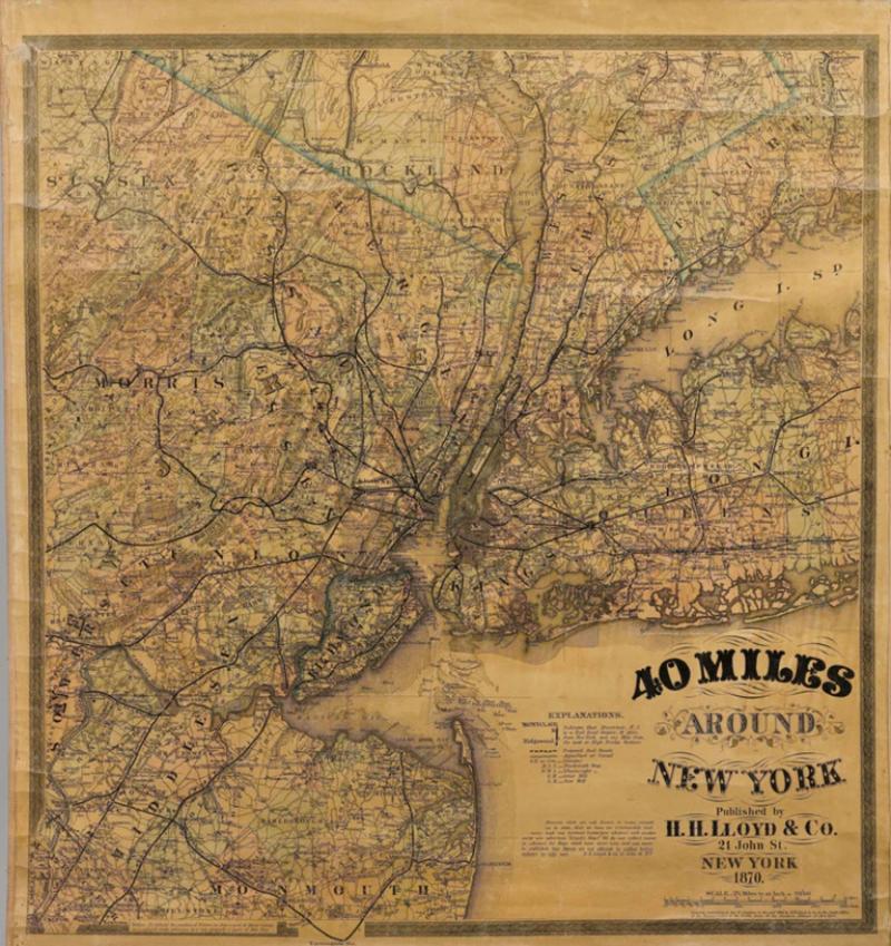
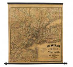
1870 "40 Miles Around New York" by H. H. Lloyd, Hanging Map on Original Rollers
-
Description
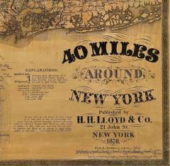
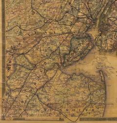
This is an antique hanging map, “40 Miles Around New York,” published by H. H. Lloyd in New York in 1870. Presented on its original wooden rollers, this small-scale lithographed wall map is centered on Manhattan and its surrounding counties. Throughout the map, the counties are colored and the towns and cities well labeled. A reference key in the bottom margin provides symbols for railroads, railroad stations, proposed railways, aqueducts and canals, cemeteries, blacksmith shops, wheelwrights, grist mills, and sawmills. This map is especially notable for the countless railway lines and stations depicted, with distances in miles noted between stations. Lloyd’s “40 Miles Around New York” was first issued in 1867 as a folding pocket map.
This map offers interesting insight about the map trade of the times, revealing the competitive nature of print publishing. In the lower margin, Lloyd warns customers of another, similar sounding named map business, presumably map dealer and known rival J. T. Lloyd. He states, “reasons that are well known to many compel us to state that we have no relationship and never had any business connection whatever with another party who advertises ‘Lloyds Maps.’” He also reminds his customers against potential fraud, stressing “We do not collect money in advance for Maps which have never been, and can never be, published. Our agents are not allowed to collect before delivery in any case.”
Henry Huggins Lloyd was born in Blandford, Massachusetts, in 1828. With his brothers, James Lloyd and Myron Lloyd, he worked as H. H. Lloyd & Co., mapmakers and maps publishers based in New York City. H. H. Lloyd & Co. had an impressive map output, especially during the Civil War. He issued maps of coastal cities and harbors, military maps of the northern and southern states, maps of key battle states like Virginia and New York, as well as larger United States maps with emphasis on the burgeoning network of railroads.
CONDITION:
Very good condition, considering age and past use. Lithographed wall map with original hand coloring. Colors are attractive, without significant fading. A few edge chips from rolling, cracks, and minimal stains. Overall toning and varnish lightly patinated. Map is backed on linen. Presented on original wooden rollers, as issued. Map has been restored and stabilized along the top. Map is sold unframed, as-is.
Unframed dimensions: 31”H x 28 3/4”W.
Accompanied by our company's letter of authenticity. -
More Information
Documentation: Documented elsewhere (similar item) Period: 19th Century Condition: Good. Styles / Movements: Modern Incollect Reference #: 768115 -
Dimensions
W. 28.75 in; H. 31 in; W. 73.03 cm; H. 78.74 cm;
Message from Seller:
Established in 2010, The Great Republic specializes in one-of-a-kind collectibles that honor American history, with a special focus on the rare and unique. Our collection is complete with rarities that are sure to wow, such as first edition books, antique hand-sewn flags from the Civil War, vintage travel posters, and original signatures from American presidents, such as George Washington and Abraham Lincoln, just to name a few. P: 719.471.6157 E: headquarters@great-republic.com
Sold


